Kannur Old and Now Part 2 Payyambalam
See the previous post Here.
So I am not new to this area at least, and now I tries to compare two maps.
 |
| A MAP of MAlabar collectorate. 1893 |
 |
| Left is the google map and right is the map of 1860 of Kannur contonement area. |
So I am not new to this area at least, and now I tries to compare two maps.
1. 1860 hand drawn map of Cannanore Cantonement. scale to 400 feet to 1 inch
2. 2010-2013 Google satellite map approx.from 500 meter above
Start with Payyambalam, you can note the space for Payyambalam Park, bay Heights sreerosh properties,and a number of high rises,Payyambalm munamb,Ursuline HS School,Church and GVHSS for girls.


The Marsh land is alomost converted into a well populated area centered by a childrens Park. Real estate lobby's high rised bussiness is flourishing this posh area. Payyambalam Munamp is reclaimed by the army.The roads are still same with almost same width. The Payyambalam Beach road is only the additional road made after.
Now Check some of the old photos of this area and its present condition.
 |
| Payyambalam Bridge 2011 |
 | ||
| Cannanore: beautiful north beach looking south.1921
|
   |
| Sea shore in Cannanore." Creator: unknown Date: 01.01.1901-31.12.2010 |

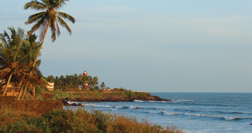
Light house in 1939, probably after shifting it to this location from Kannur Fort.
 |
| Cannanoor Creator: Gtz, Martha (Ms) Date: 20.05.1928-10.04.1939 |

 |
| Sunset at caannanur." Date: 01.01.1932-31.12.1933 |


Gvhss for Girls- location of new Building.

Relativley new image of same spot.

No comments:
Post a Comment
Please leaveyou your valuable query here. I am Happy to assist you